29,743 or 29,800: What is the Territory of the Republic of Armenia?
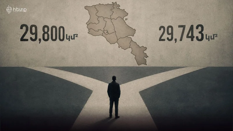
29,800 km² or 29,743 km²? Since the start of the first session of the newly elected National Assembly, the area of the Republic of Armenia and its accuracy have become one of the key topics of parliamentary discussions. Both government and opposition MPs have cited a variety of sources, from Soviet encyclopedias to school textbooks. Ultimately, where did the discrepancy originate, and what do the official figures show? This is discussed by Hetq.
“How did the topic come to be raised in the National Assembly?” Starting from the first session of the 9th convocation, opposition MPs from the “Armenia” faction have been questioning government members about whether Tigranashen is included in the territory of the Republic of Armenia. Eventually, the questions reached the issue of whether the territory of the Republic of Armenia is 29,800 or 29,743 km².
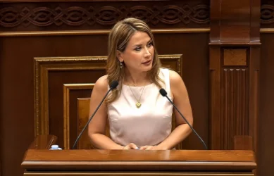
MP Artur Khachatryan from the “Armenia” faction asked MP Arusyak Julhakyan from the “Civil Contract” faction: “Finally, what is the configuration of the RA borders, and how much is the territory of the RA? You say that the territory is determined by the Alma-Ata Declaration, which viewed the administrative borders of Soviet Armenia as state territories. Am I interpreting your and your faction's statement correctly?” (Arusyak Julhakyan responds positively from the podium).
“Very well. During the Soviet era, there was no general law on administrative territorial division. Each republic's territory was determined by decisions of its supreme soviet, decisions of the councils of ministers, and so on. However, those defined areas were recorded in different places, such as maps published during the Soviet Union, and in other official public documents, encyclopedias. I particularly mention encyclopedias because during the delimitation, when it came to what relevant documents were used, encyclopedias were also mentioned.”
Khachatryan goes on to read an excerpt from a Soviet encyclopedia published in 1980, stating that the territory of the Republic of Armenia is 29,800 km². “I am curious, when did those 57 km² disappear?”
In response to this question, Arusyak Julhakyan replied, “If you are interested in the specific date when it became 743, I can't specify an exact date. If you remember, initially, the Prime Minister also mentioned the number 800, but I must tell you that in our textbooks, in the Soviet encyclopedia, and independently in the textbooks of the Republic of Armenia, which we studied, it is stated as 29,743 km², and I assume that is when the transition occurred.”
How, when, and by whom was the territorial data changed? Prime Minister Nikol Pashinyan has repeatedly confirmed in his speeches that the territory of the Republic of Armenia is 29,800 km². Moreover, on June 1, 2023, during a meeting with the Armenian community in Chișinău, Pashinyan declared that Artsvashen is also included in the 29,800 km².
However, there was a shift in the Prime Minister's rhetoric following a meeting with Azerbaijani President Ilham Aliyev, mediated by European Council President Charles Michel, on May 14, 2023, in Brussels. Pashinyan shared details of the discussion during a press conference on March 12, 2024: “You can imagine the escalation of the situation when both sides need to state, ‘Our country’s territory is this much.’ An idea emerged there, let’s declare the number that is fixed in the last edition of Soviet encyclopedias once we get out of here. I contacted our colleagues from the hotel and said, ‘Take the information about the RA and Azerbaijan from the title page of the encyclopedias and send it, although I remembered that number - 29,800 km².’ Those figures were communicated to the President of the EU Council, and he published those numbers. Later, when we examined more closely and saw that there were other figures in the encyclopedia, the heading stated 29,800 but it turned out that was a rounded number; in the text, it mentioned 29,743 km². Then Azerbaijan pointed out that in several state bodies of Armenia, I confirmed that this data had been in place for decades, where the RA territory was stated as 29,743 - another figure which is less than 29,800 km². The same applies to Azerbaijan, because there is a title number and a more detailed one. It was these two numbers that caused certain tensions, mutual deep suspicions, and so forth.”
Thus, the official discourse of the Armenian authorities regarding the RA territory changed not due to data published in textbooks, as Julhakyan claims, but precisely at the moment when Nikol Pashinyan and his team began to use the figure of 29,743 km². For years, the figure 29,800 km² was presented as the unquestionable sovereign territory of the Republic of Armenia and was brought to the negotiation table, but gradually, the leadership and its team began to push that data out of public discourse, replacing it with 29,743 km².
For more, visit the source.
Նմանատիպ հոդվածներ
We Have Taken a Blank Sheet and Started Writing the Text of a New Constitution: Arusyak Julhakyan
No part of the Constitution text has been removed because we are writing a new Constitution. We haven’t taken the Consti...

Law Enforcement Raids Narek Karapetyan's Residence
This morning, law enforcement agencies entered the residence of Narek Karapetyan and are conducting searches, reported "...
Armenian Government to Introduce New Economic Reforms
The Armenian Government is set to announce a series of economic reforms aimed at improving the country's financial stabi...
Alen Simonian Comments on Grigoryan's Resignation from Secretary of the Security Council
The new Secretary of Armenia's Security Council, Alen Simonian, stated in an interview with 24news.am that he does not c...
Ավելին Politics բաժնից

German Foreign Minister Calls Lavrov's Threats 'Nonsensical Propaganda'
Turkey’s Foreign Ministry Strongly Condemns Israeli Strikes on Military Base in Syria
Azerbaijan's Wanted Chadayev Resigns