The Area of the Burned Territory in Khosrov Reserve is Revealed: New Data
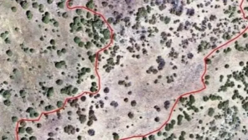
The results of the research carried out by the Ministry of Environment's Hydro-Meteorological and Monitoring Center have been announced. It is reminded that an assessment of the area burned in the "Khosrov Forest" state reserve, which erupted on June 18, was conducted using a drone to obtain an orthophoto map.
According to the analysis of the orthophoto map, it has been determined that the burned area measures approximately 4.4 hectares. The count of burned, partially burned, and undamaged trees within the area affected by the fire was also calculated. A total of 1,073 trees were recorded in the burned area, of which 395 were completely burned and 466 were partially burned.
Նմանատիպ հոդվածներ

415 New Cases of Coronavirus Infection in Armenia: 14 Deaths, 4 from Other Illnesses
As of June 30 at 11:00 AM, 415 new cases of coronavirus infection have been registered in Armenia. This information was...

Armenia Leads the Region with Highest COVID-19 Infection and Mortality Rates Per Million People, Ranks 10th Worldwide
Armenia is the leader in the region with the highest COVID-19 infection and mortality rates per million people. Accordin...

10 Children and 5 Staff Members Test Positive for Coronavirus at Gyumri's Fridtjof Nansen Children's Shelter No. 2
Coronaviruses cases have been confirmed at the Fridtjof Nansen Children's Shelter No. 2 in Gyumri just one hour ago. The...

Police Are Now at TV5, It's Shameful: Agnesa Khamoyan
Agnesa Khamoyan, a presenter at TV5, has announced on her Facebook page that police officers are currently at the televi...
Ավելին Other բաժնից
20:000 News in One Line: 11 Deaths in the Army, Revocation of Guloyan’s House Arrest

19:00 News in Brief: From Garegin B's Case to Bribery Scandals and Russia's Secret Plans
18:00 News in Brief: New Details on the Fire Incident in Azat Village, Russian Wheat to Armenia